This was a very complicated ASM observation to analyze. First of all,
it involved SSC 3, which is suffering from the loss of four of its
eight position-sensing anodes. This renders the long axis of the
error box very difficult to constrain. However, since the source
was still active after a rotation of the ASM (see light curve,
below), two crossed lines of position were calculated:
Localizations of GRB 000508B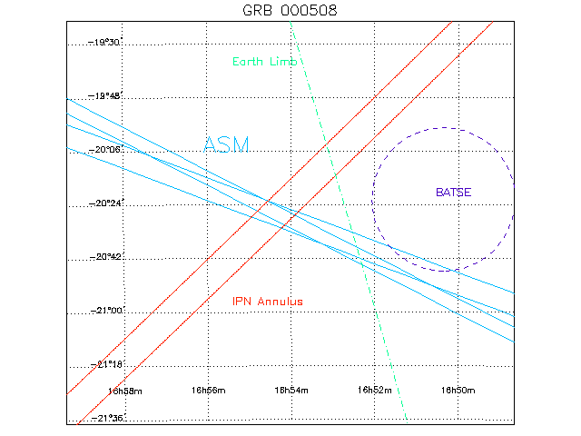
Further complicating matters was the fact that the Earth was occulting over 30% of the field of view, and the limb of the Earth was very near the reported BATSE position for this burst. Everything to the East of the broken green line lies below the horizon at the start of the first ASM observation (the horizon is calculated assuming that the Earth subtends a 68.5° angle from the position of the spacecraft). The best-fit position for the GRB actually rose above the horizon during the first ASM dwell after the BATSE trigger. We therefore believe that the rise depicted below is due to the Earth moving out of the line of sight, and not any property of the GRB.
Light Curve for GRB 000508B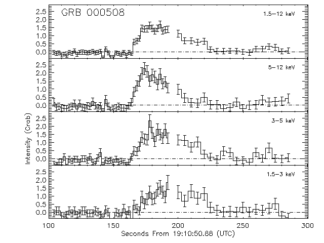
This page written and maintained by Don Smith. |