Event time: UT 03/02/14 05:55:55
An Alert Message for this source.
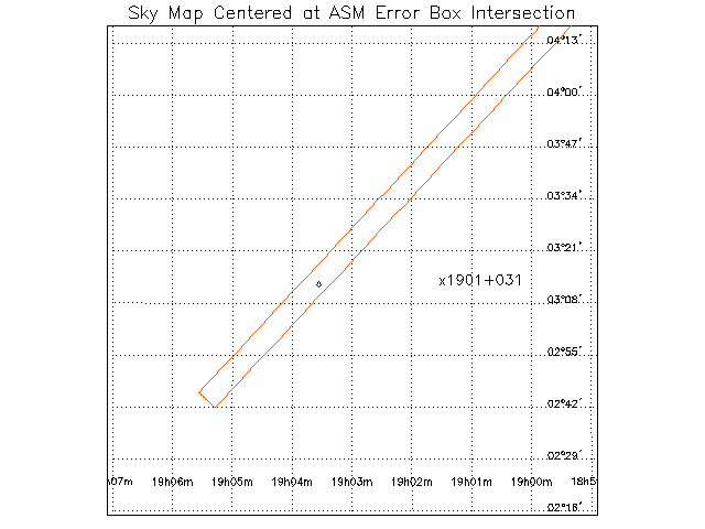
Sky Map
If you have a SIMBAD account, you
can also query that database for nearby known celestial objects.
To see a list of everything catalogued within a 30 arcminute radius
of RA=285.75 and Dec=3.26666666666667, click
here.
Please visit the SIMBAD site to see their terms of use.
ASM Multiple Time-Series Data


More on the sky map:
The ASM map is centered on the center of the
diamond intersection of two ASM error boxes. The size of the map is
scaled by the size of this error box. If there is a recent BATSE
alert, the BATSE circle will also be plotted on this map, unless it
falls beyond the range considered. Known X-ray sources from the full
ASM catalog are also plotted as diamonds, with labels to the right.
For each dwell that contributed to the alert, a plot of the
three-energy-band time-series data will be included in this web page.
The count rates are displayed in 1-s bins, and the X-axis is labelled
in seconds from the BATSE trigger time, if there was a recent BATSE
trigger. Otherwise, the zero point is simply the start of the 90-s
observation. If there are multiple alerts from the same part of the
sky, the MTS data from later observations is only plotted if there is
evidence for unusual variability.
This web page is designed to help you easily evaluate the ASM rapid
"crossbox" alerts. Please direct any suggestions you might have to
make this page easier to understand to Don Smith.